
Corrientes migratorias
gustoporlahistoria.wordpress.com/.../

Affichage des articles dont le libellé est mapas. Afficher tous les articles
Affichage des articles dont le libellé est mapas. Afficher tous les articles
dimanche 11 avril 2010

vendredi 10 juillet 2009
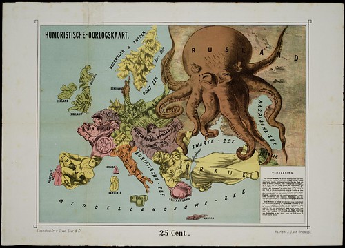 Humoristische-oorlogskaart'
(Humorous War Map)
Published in Haarlem by J.J. van Brederode in 1870
Image source: University of Amsterdam
Tomado de: http://bibliodyssey.blogspot.com/
samedi 20 juin 2009

lundi 16 février 2009

dimanche 16 décembre 2007
Race and Hispanic Origin Population Density of the United States: 1990
(by County as a Percentage of Total Population)
1
 2
3 
 4
- [ American Indian, Eskimo, and Aleut Persons] (1.17MB)
- [ Asian and Pacific Islander Persons] (1.21MB)
- [ Black Persons] (1.18MB)
- [ Hispanic Origin Persons] (1.24MB)
lundi 10 décembre 2007


mercredi 5 décembre 2007

jeudi 29 novembre 2007

Inscription à :
Articles (Atom)

